Dancing on water in the Norwegian mountains

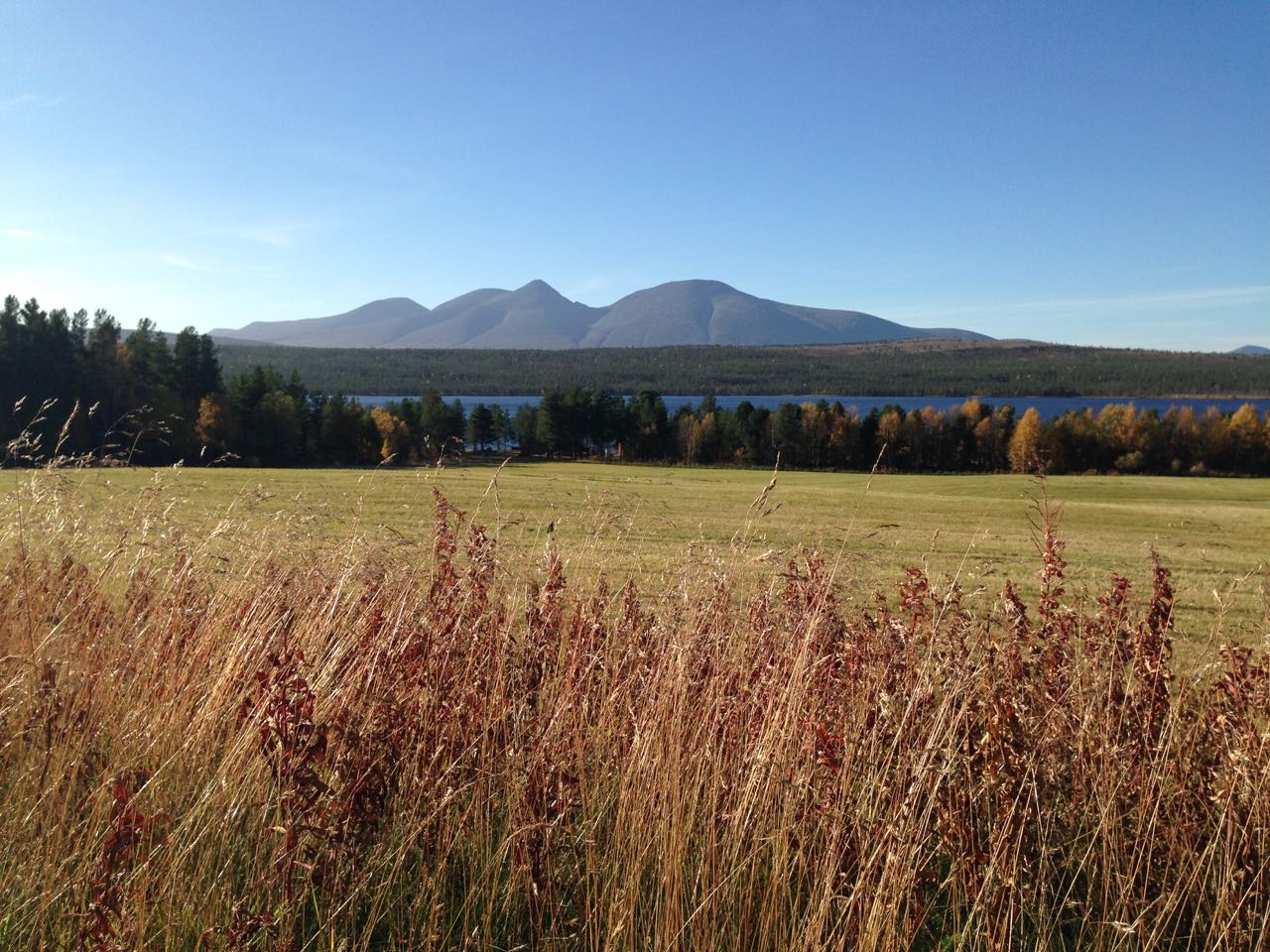
This week we’ve been out in the mountains hiking, wading, climbing and sun-bathing. We’ve been very lucky with the weather meaning sun almost every day and the lakes have been clear as a mirror. In the mornings a thin layer of ice has covered the lakes and if I would have taken a few moves on the ice it would have felt like dancing on water. But… those who know me also knows that I wouldn’t risk falling into that freezing cold water 😉

IMG_7649

Ready, set, go! ”Hiking in autumn” here we come.

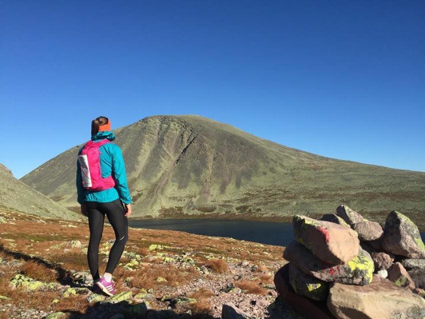
Hiking in different terrain

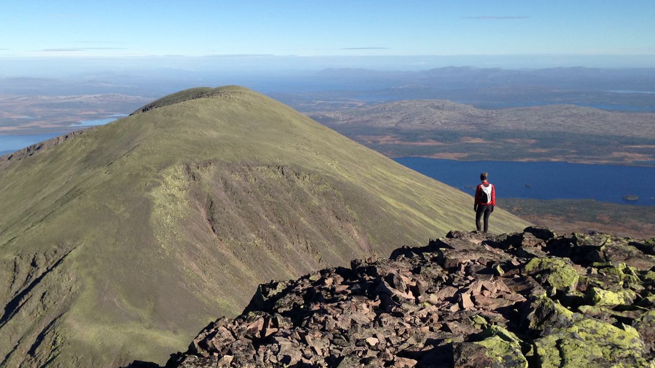
On the pictures you can see all the different terrain we’ve been hiking us through. The most challenging hike was when we climbed from the north-east side up on Mitretoppen, Rendalssølen 1755 m. This is the second time in two weeks I’m up on this top, but this time I climbed it from a different angle – and also through some snowy and slippery parts.

OLYMPUS DIGITAL CAMERA

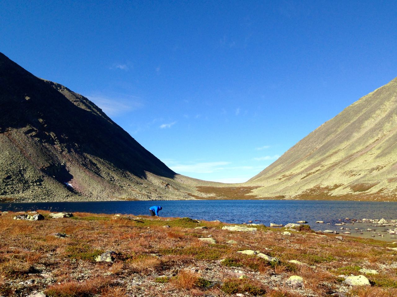
Crossing water by wading. It was really cold. Here I’m not dancing – but very focused so I won’t fall and also get my backpack all wet.

OLYMPUS DIGITAL CAMERA

Wet wet wet…

IMG_7711

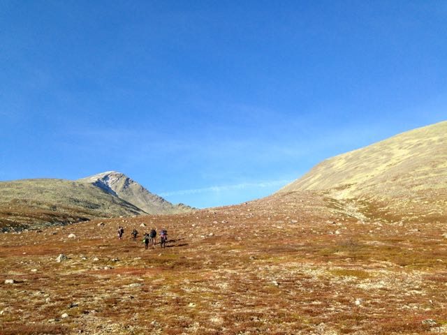
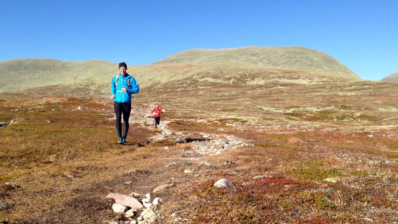
On our way towards Mitretoppen.

IMG_7749

Climbing on rocks, from the north-east side, with Mitretoppen 1755 m. as our goal.

Orientation in the night

The most exciting and nervous thing on this tour was yesterday. We had a night activity and the mission was to get back to the cars (the location for the cars was pointed out on the map). And we had to do this at night with just a head torch, compass and a map – and all by my self! For me this was a real challenge because I’m not very comfortable being out in the mountains in darkness, all alone and just navigating with a compass and a map. Anyway… It took med 2,5 hours to get to basecamp and the total distance ended up in 9 km. I felt very lucky when I reached the goal and proud that I had won over my fear.

IMG_7822

Some relaxing and preparation time before the night orientation will start.

IMG_7838

Still a little time until it gets dark. What doesn’t kills you makes you stronger.

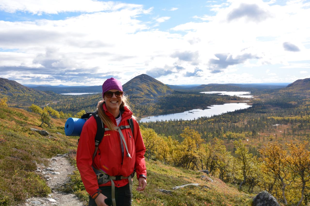
More pictures from our week in Rendalssølen, Norway.

IMG_7657

Open up your mind and you’ll see the shape of a heart.

IMG_7667

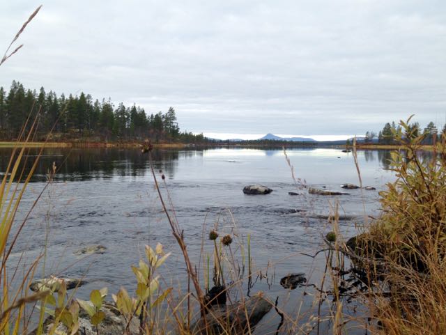
The mountains reflected in the water.

IMG_7689

Just stunning! Sølentopparna and a crystal clear lake makes a perfect couple.
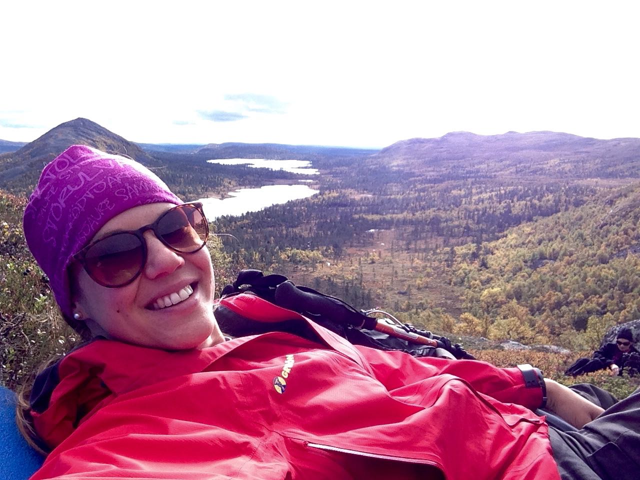
IMG_7692

Mountain-selfie!

IMG_7734

Lunch-time. Egg, noodles with bacon flavoured with curry. One of the easiest meals to make. And outdoors everything taste so much better.

IMG_7720

My class mates.

IMG_7752

Me and Ida up on Mitretoppen, 1755 m. We did it!

OLYMPUS DIGITAL CAMERA

My awesome class – all together up on the top!

IMG_7804

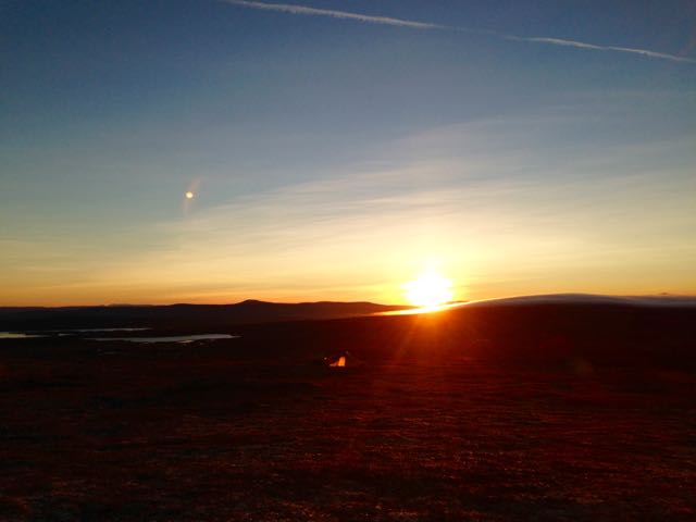
Waking up to this beautiful sunrise makes the whole day!

IMG_7815

We changed camping spot every day and got to see a sunrise almost every morning.

IMG_7841

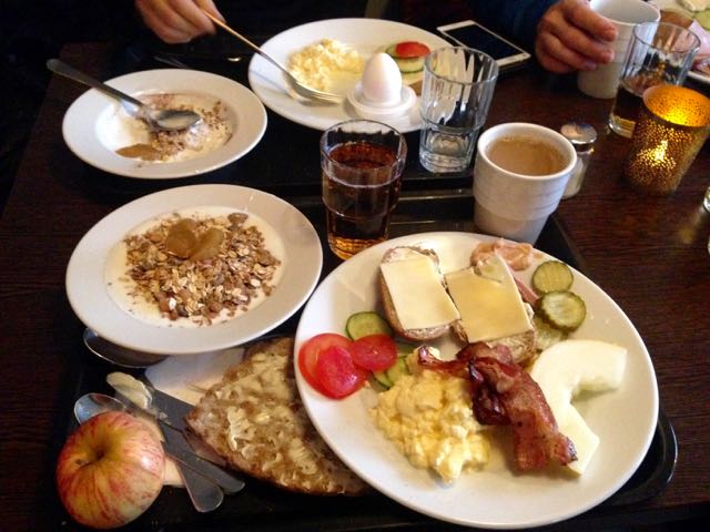
Back in Älvdalen we stopped for a big breakie at the hotel. Thank you for a wonderful week with YH-fjäll 15/16.

Hiking and being out in the mountains when it’s autumn is the best time of the year. If you’ve never tried it just give it a go. The nature fills you with new and positive energy. If you feel unsure how to do just start with an easy daywalk – you don’t have to stay over night to be out in the mountains. Or join experienced friends or go on a guided tour. The tours usually have the equipment you’ll need (to borrow or for rent) and know how to act/about safety when you’re out in the wilderness.

Linnea

The top of the Queen

This weekend I’ve been up in the mountains in Grövelsjön and its surroundings. The autumn has shown it self from its most beautiful side, with all the yellow and red colors and also a sun that is still warming. In Rendalens community you can find a dramatical mountain with three tops which together goes under the nickname ”The Queen”. The real name is Rendalssølen and the highest top is called Store Sølen, 1755 m. But it’s not just the top that makes it worth going there. The track all the way to the valley, the crystal clear lakes and the massive mountains give that little extra to get the perfect cinnamon bun. From Grövelsjön it takes about 1 h and 15 minutes drive. And from where the hike starts it took us 4 h and 20 minutes with return, total distance 24,5 kilometers. Note that we did jogging, a bit of walking and also took a 30 min stop on the top for a lunch break. Before continuing the last 500 height meters to the top you should refill your bottle with water (down in the Valley).

IMG_7111

Rendalssølen from a distance. The highest point, which looks like a shark fen, called Store Sølen (1755 meters above sea level), is where we went up.

IMG_7037

On the ”road” again. High on mountain life.

IMG_7078

Taking the opportunity to refill the water tank.

IMG_7102

The Valley, up on 1200 m.

IMG_7063

My friend is looking out over Norway with its spectacular view.

IMG_7245

It’s quite steep on the top. But with an incredible view.

IMG_7242

Go, go, go. And in between, remember to slow down, breath and enjoy the mountains.

IMG_7104

The track and environment invites to jogging.

IMG_7250

Thank you Rendalssølen for my first visit to you.

Linnea

A 360 degree view over the Norwegian mountains

Båthusberget is a spectacular mountain located in Norway. From Grövelsjön (which is located close to the Norwegian border) you can take the car to where the track starts, it’s about 15-20 min drive. The total hike is nine km and takes you up on Båthusberget. It’s considered as one of Grövelsjöfjällens most beautiful hikes. Some parts are quite steep and raises your pulse. At one point of the track you can choose to walk right- och left lap. If you choose right lap the track will be more steep uphill to the summit and downhill the inclination will be less steep. This lap is recommended because it’s easier to take the steepest part walking uphill. Along the track you can refill your bottles from the streaming water. The vegetation offers different kind of old and impressive trees, flowers, lakes and a beautiful 360 degree view over the Norwegian mountains. Total inclination in meter is 500.

IMG_6819

Walking the right lap with another mountain in our background, called Herbenser.

IMG_6705

Starting the track and walking in the forrest.

IMG_6730

Life as a guide.

IMG_6723

Good company makes the trip something little extra.

IMG_6734

Both people and dogs were on this guided tour.

IMG_6776

Some parts are more steep. You need to stay focused and look where you put your feet.

IMG_6779

Båthusberget from below.

IMG_6823

A pleasant tour with an amazing group and beautiful weather.